Webinar- Beyond Flood Maps: Using GIS for calculations and statistics in the NFIP CRS Review
The National Flood Insurance Program’s (NFIP) Community Rating System (CRS) is a voluntary incentive program that recognizes and encourages community floodplain management activities that exceed the minimum NFIP requirements. As a result, flood insurance premium rates are discounted to reflect the reduced flood risk resulting from the community actions meeting the three goals of the CRS:
- Reduce flood damage to insurable property;
- Strengthen and support the insurance aspects of the NFIP, and
- Encourage a comprehensive approach to floodplain management.
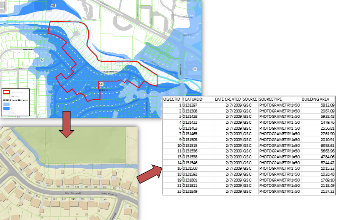
GIS can be an integral part of the CRS process by providing calculations and products that are needed to help show the work that was done by a community in preparation for the final review by FEMA.
What you will learn:
- Why GIS is an integral part of the process.
- How GIS can provide information beyond simple maps including calculations and statistics.