Empowering Village Staff with Tools For a Bright Future
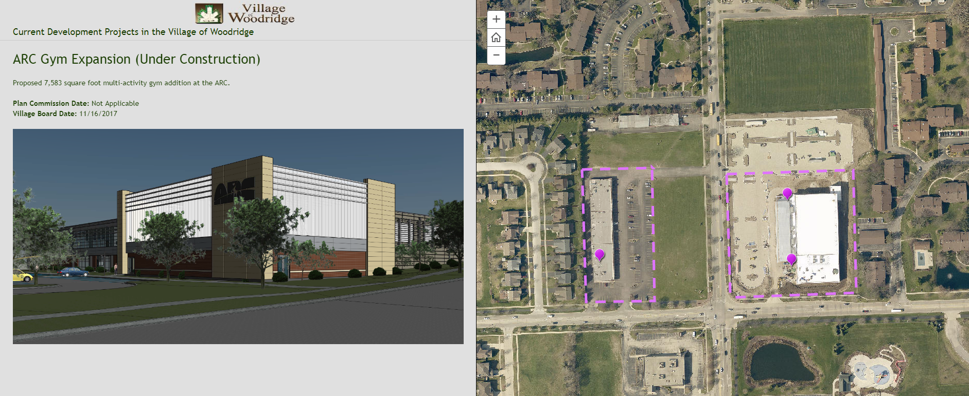
Click image to view Story Map
One of the greatest challenges with local government data is finding relevant, simple, and efficient ways to share information in a meaningful way. Visualizing data to provide clarity and transparency to residents is one of the most important elements of data management. ESRI’s Story Maps are a unique tool that can do just that!
Innovating Data Visualization
The Village of Woodridge was looking for a practical yet innovative way to communicate the community’s Current Development data to residents to highlight new businesses being erected in town. The Community Development Department inquired with GIS Specialist Nate Rock to see what ideas he had up his sleeve that would suit their needs. After understanding the scope of the project, he knew an ESRI Story Map would be the perfect solution!
Setting Up For Success
Story Maps are a unique interactive tool that allows individuals to maintain and display relevant content and images designed to tell a story or relay a message. Nate explained the components of how a Story Map functions to the Village staff and that it could serve as the perfect tool to convey their Development information. He worked with the staff to create an initial version of the Story Map, taught them how to independently make changes, and also created project documentation so they could refer back to it if they needed assistance when he was not available.
Empowering Community Development
One of the greatest benefits that came of this project was empowering Village staff to edit the data by themselves. Allowing staff to make updates independently provides efficiency in the project’s process and gives staff ownership of their own data. It allows the GIS specialist to oversee the project and frees up time for them to work on other projects. Notably, confusion between departments is eliminated and staff can simply change content independently as needed. Secondly, the Village staff feel accomplished and can understand the impacts of their changes. Lastly, the project documentation provides a clear, reliable resource for current and future individuals who are making updates to the map. A documented process encourages consistency and serves as support in a time of need.
The Current Developments Story Map has inadvertently strengthened the Community Development staff’s relationship with their GIS program. In addition, the department has shown interest in future collaborative projects with GIS. This project kicked off in Fall of 2017 and the Development staff has already inquired about creating an additional Story Map for another project—how exciting! Providing staff with visualization tools takes coordination and cooperation, however, the benefits for future projects are well worth the investment–the sky is the limit! Check out the Current Developments Story Map here!
Take the Lead
Discover, innovate, and collaborate with the GIS Consortium today! Contact your community’s GIS Specialist to discuss project opportunities, Consortium services, and GIS.
If you would like to learn more about this initiative or if you have questions, please contact agrahovac@mgpinc.com.
Author: Megan Loker, GIS Specialist

