Webinar- Using Data to Restructure Boundaries and Optimize Coverage
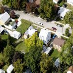
Emergency responders such as Police, Fire, Public Works, and Health aim to serve their communities best by providing coverage where it is needed most. GIS analysis can help departments identify where they are currently providing coverage and where there may be gaps in service to help maximize efficiency and help staff understand a community’s level of service to their residents. Not only can this analysis help define important police beat and fire response boundaries, but it can also help optimize yard waste pick up, insect spray zones, snow plow routes, and other area-based services to reduce time spent and save money.
What you will see:
- Restructuring Police Beats based on real data
- Identifying zones with critical emergency needs
- Plan routes and coverage to enhance efficiency